IGRSM 2020 - "Advancing Geospatial 4.0"


Proceedings of the 10th IGRSM International Conference and Exhibition on Geospatial & Remote Sensing (IGRSM 2020)


YBhg. Datuk / Prof. / Gs. / Ir. / Sr. / Dr. / Sir / Madam

The 10th IGRSM International Conference and Exhibition on Geospatial & Remote Sensing (IGRSM 2020) was held online on 20-21 October 2020: http://www.igrsm.org/igrsm2020

We would like to thank all our Sponsors, Co-Organisers, Supporting Organisers, Media Partners, keynote speakers, presenters and participants for their invaluable and continuous support in organising the conference.

The proceedings of the conference has been published in IOP Conference Series: Earth and Environmental Science and is available at: https://iopscience.iop.org/issue/1755-1315/540/1

Thank you.
20 - 21 October 2020 KUALA LUMPUR, MALAYSIA

New: PDF Version of the Program is Available from Here
 
MANUSCRIPTS SUBMISSION

Abstract / paper submission is now CLOSED


As we are no longer accepting submission of full manuscripts, the EasyChair system has been closed.

Nonetheless, we are still accepting abstracts for oral / poster presentations at the conference up until 9 September 2020, which can be submitted to igrsm.conf@gmail.com


Disclaimer:

1. The conference proceedings is expected to be published in IOP Conference Series: Earth and Environmental Science on the second day of the conference: 21 October 2020.
2. Any submissions after 6 May 2020, as well as full manuscripts that have not been finalised by 16 June 2020 will only be considered for oral / poster presentation without publication in the proceedings.


Manuscripts should be prepared according to the format of the IOP Conference Series. The template can be downloaded from here
All Manuscripts submissions are done through EasyChair portal. Please click here for the submission
The call for papers can be accessed from here
CONFERENCE TOPICS
Remote sensing technologies and applications
GIS technologies and applications
Geospatial technologies, industries & applications
Geospatial for research and management
Space borne systems for terrestrial and marine
Satellite sensor systems and applications
Space borne, airborne, Unmanned Aerial System/Vehicle (UAS/UAV)
Lidar techniques and applications
Hypespectral techniques and application
Geomatic and Surveying Sciences
Environmental sciences, mapping, monitoring
Climate Change impact assessment, modelling and predictions
Forestry and agricultural applications
Smart Agriculture
Smart Forest
Marine and maritime applications
National Defence and Controls
Health and diseases monitoring
Disaster Management
Others related technologies and application
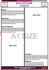
Poster Template
The posters template is now available for download from the following links:

ABOUT IGRSM

IGRSM, formerly known as Malaysian Remote Sensing Society (MRSS), was formed in July, 1995. Its overall objective is to support and facilitate development of geospatial and remote sensing technologies in the country.


Since its formation, IGRSM has embarked in several activities aimed towards further promoting the use of the technology, strengthening government-private sector interaction, encouraging more publications of R&D results and keeping members duly informed of geospatial and remote sensing activities within and outside the country.


CONTACT

IGRSM
Geospatial Information Science Research Center

(GISRC),

Level 6, Tower Block, Faculty of Engineering,

Universiti Putra Malaysia, 43400

Serdang, Selangor, Malaysia


Tel: (+6) 010-439 8638

Email: igrsmalaysia@gmail.com

Copyright © 2020 IGRSM All Rights Reserved. V6.5