Slide Background

Institution of Geospatial and Remote Sensing Malaysia (IGRSM)

Slide Background
IGRSM Conference 2024
previous arrow
next arrow

1. High Court Grants Interim Stay on Licensed Land Surveyors Act – Official Stay Order

2. IGRSM is a supporting organiser for the National Agricultural and Food Engineering Convention 2025 (NAFEC 2025).

3. IGRSM is a co-organiser for the 7th International Conference on Agricultural and Food Engineering (CAFEi 2025)

4. The 2025 Annual General Meeting (AGM) of IGRSM will be held on 24 April 2025 (Thursday), 5.00 – 7.00 pm at Dewan Taklimat, Level 2, Tower Block, Faculty of Engineering, Universiti Putra Malaysia (UPM), 43400 Serdang, Selangor

Cover for Institution of Geospatial and Remote Sensing Malaysia - IGRSM
2,590
Institution of Geospatial and Remote Sensing Malaysia - IGRSM

Institution of Geospatial and Remote Sensing Malaysia - IGRSM

IGRSM's overall objective is to support and facilitate the development of geospatial and remote sensing technologies in various fields in the country.

We would like to invite you to attend IGRSM Talk 2025/1, which will be held on 24 April 2025 (Thursday), 2.00 - 4.30 pm at Dewan Taklimat, Level 2, Tower Block, Faculty of Engineering, Universiti Putra Malaysia (UPM), Serdang, Selangor, with presentations on:• Digital Landscapes: Transforming Civil Engineering with Geospatial Intelligence by Ir. Ts. Gs. Br. PMr. Dr. Cassidy Anak Morris, Director of Public Works Department (JKR) Sarawak• UzmaSAT-1: Malaysia’s Leap into High-Resolution Remote Sensing by Mr. Mohammad Fadhli Jamaluddin, CEO of Geospatial AI Sdn. Bhd.Further details on the talk are available at: shorturl.at/OOzEf ... See MoreSee Less
View on Facebook
Following our recent announcement on the judicial review against the Licensed Land Surveyors (Amendment) Act 2024 and its corresponding regulations, we are pleased to inform you that the High Court of Malaya has granted an interim stay order in favour of the Institution of Geospatial and Remote Sensing Malaysia (IGRSM) and its members.This means that, pending further proceedings, the amended provisions will not be enforced against IGRSM members until the main stay application is heard. However, IGRSM will continue to argue that the stay should extend to all affected geomatics professionals, rather than just its members.Key Updates:• Interim Stay Granted – The legislative amendment temporarily halted for IGRSM and its members.• Next Court Date: 9 April 2025 – Case management to determine further legal proceedings.• Judicial Review Continues – IGRSM is actively pushing for a broader stay covering all affected professionals.For your reference, the official stay order is available at: shorturl.at/TrWpYYour support remains crucial in this legal challenge. If you wish to contribute to the Geomatics Legal Fund, contributions can be made via:• Bank: Maybank• Account Number: 562142808476• Account Name: Persatuan Geospatial dan Remote Sensing• Reference: [Your Name / Organisation]For inquiries or to request an official receipt for contributions, please email us at igrsmalaysia@gmail.com.We will keep all members updated as the case progresses. Thank you for standing with us in protecting the rights and livelihoods of geomatics professionals. ... See MoreSee Less
View on Facebook

IGRSM YouTube

Our Activities

IGRSM, formerly known as Malaysian Remote Sensing Society (MRSS), was formed in July 1995. Its overall objective is to support and facilitate the development of geospatial and remote sensing technologies in the country.

Conferences

Membership

Publication

Membership

For professionals, academics and students in the field of geospatial and remote sensing, we welcome you to become members of IGRSM.
Latest Newsletter

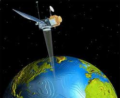
Currently, IGRSM is publishing three categories of publications which are newsletter, reports and journals. Journals are open to public to send out your article to us.

Any Question?

IGRSM, formerly known as Malaysian Remote Sensing Society (MRSS), was formed in July, 1995. Its overall objective is to support and facilitate development of geospatial and remote sensing technologies in the country.